

Geography, Planning, and Sustainability News
MRP Student Samuel Hass Wins Third Place for APA Paper Submission
Congratulations to Master of Regional Planning (MRP) student Samuel Hass who has been awarded third place for his submission to the American Planning Association's (APA) 2022 Transportation Planning Division Student Paper Competition. Hass's paper was entitled, "All-Aboard to Mexico: The Potential for Passenger Rail."
Prof. Andrei Lapenas Discusses IPCC Report on WAMC
The United Nations’ Intergovernmental Panel on Climate Change recently released its Sixth Assessment Report, described as the most up-to-date assessment of the global climate system and climate change. The news is not good. According to Dr. Andrei Lapenas, the projections and data outlined in the report echo climate predictions made in the early 70’s by a Soviet climatologist named Mikhail Budyko. Dr. Lapenas is a climate scientist and Professor of Geography and Planning at the University at Albany. He was an author of the first IPCC report in 1990, and was also a mentee of Mikhail Budyko.
Congratulations to the 2021 GP Student Award winners!
Congratulations to Geography and Planning students Jesse McCaughey, Ben Turin, Jonathan Kappel and Falon Treis for winning these outstanding 2021 awards:
American Planning Association (APA) Outstanding Planning Student Award, Paul D. Marr Memorial Award for Excellence in Planning, David Mark Prize in Geography: Graduate award, and MSGIS student’s NISS Award.

Conference Seeks Racial Justice in Planning Neighborhoods
United States zoning laws are the legacy of racism, according to participants in the five-day Planning for Racial Justice Conference that begins Feb. 23.

GP Grad Student Chris Plummer gets spotlighted in eSpatially New York
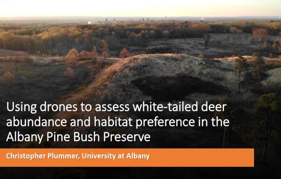
Geography and Planning graduate student Christopher Plummer is spotlighted in eSpatially New York in the Geospatial Student Spotlight section. Chris is pursuing his masters in Biodiversity, Conservation, and Policy. His research focus is using drones to assess white-tailed deer abundance and habitat preference in the Albany Pine Bush Preserve. Read the article.

Welcome to New GP Faculty Member Jared R. Enriquez
The Department of Geography and Planning would like to welcome new full time lecturer Jared R. Enriquez this fall.
Jared begins his appointment in the Department of Geography and Planning following a year as Consortium Fellow for Faculty Diversity at St. John’s University in MN. Prior to his doctoral studies in City and Regional Planning at Cornell, Jared received a B.A. in Architecture from Yale College and Master’s in Urban Planning from the University of Michigan.
Geography and Planning Master’s student talks about his research on the use of drones to study wildlife
Christopher Plummer, a Geography and Planning Master’s student in the Biodiversity, Conservation and Policy program, has recently discussed his work to assess white-tailed deer abundance and habitat preferences in the Albany Pine Bush Preserve with the aid of thermal imaging drones. His study complements work that has already been performed and will help the Preserve staff to better understand the seasonal habits of white-tailed deer in the area. Christopher's presentation is titled, Using Drones to Assess the Winter Habitat Preference and Abundance of White-tailed Deer in the APBP.
Congratulations to Prof. Youqin Huang and Confucius Institute for winning the President's Awards for Exemplary Public Engagement
Directed by Prof. Youqin Huang, Confucius Institute at University at Albany (CI) provides support and service in Chinese language instruction and culture programming, promotes China-related research, and facilitates academic exchanges and collaborations between UAlbany and its partner university in China -- Southwestern University of Finance and Economics in Chengdu. Established in December of 2013, CI offers educational activities to not only the university population but also the large community in the Capital District.