





New York State Mesonet Tests GPS-Based Atmospheric Data to Improve Extreme Rainfall Forecasting
By Mike Nolan
ALBANY, N.Y. (Sept. 15, 2026) — The New York State Mesonet at the University at Albany is working with Skyfora, a Finnish weather technology company, to test whether dense observations of GPS signal delays can give New Yorkers earlier warning before extreme rainfall.
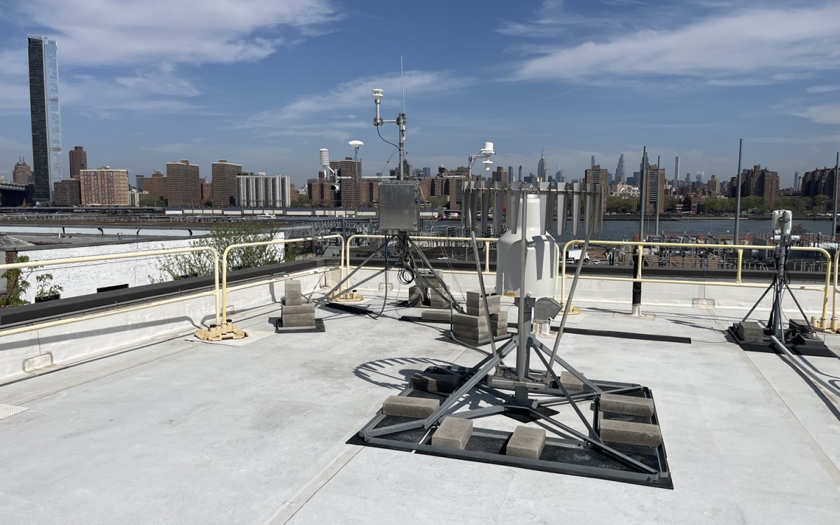
The pilot project, based in and around New York City, has added Skyfora’s ground-based satellite receivers to existing Mesonet towers to track atmospheric water vapor, the fuel for precipitation, in real time, even before rain begins to fall.
Scientists hope the added data will help forecasters spot the earliest signs of dangerous downpours and give emergency managers more lead time to warn the public.
"Our mission as a public research university is to advance science and technology while serving New Yorkers," said June Wang, director of the New York State Mesonet and recognized expert in hydrological applications of this technology. "This pilot project will allow us to test whether Skyfora’s technology provides significant advantages over other water vapor measurements and can help us give emergency managers the best available information on the risks to the public."
Sensing rain before it falls
Skyfora uses Global Navigation Satellite System (GNSS) signals to measure water vapor in the atmosphere. As satellite signals pass through the air on their way to a receiver, they slow down slightly depending on how much moisture is present.
By tracking that delay, scientists can watch atmospheric moisture build in real time and, combined with artificial intelligence, use it to sharpen short-term rainfall forecasts, a technique known as nowcasting.

The Mesonet is the nation's largest and most advanced weather observation network, with 127 standard stations spaced an average of 17 miles apart statewide. Each site is equipped with automated sensors that measure various weather data points in real time, including temperature, humidity, wind speed and direction, pressure, precipitation, solar radiation, snow depth and soil information, as well as a camera that photographs current conditions.
Among its specialty networks is the New York City Micronet, which includes 29 weather stations. Collectively, the Micronet provides critical real-time weather data for utility operations and long-term data for monitoring climate change.
Mesonet data is collected every five minutes, feeding weather prediction models and decision-support tools for users across New York. UAlbany designed, installed and continues to operate the network through the Atmospheric Sciences Research Center.
Putting technology to the test
Early results of adding Skyfora's technology to Mesonet sites are promising. During a flash flood in Brooklyn and Queens on May 20, GNSS-derived water vapor readings climbed sharply over 50 millimeters before the heaviest rain hit the ground.
"The New York State Mesonet is internationally recognized as one of the world's leading environmental observing networks, making it an ideal collaborator for demonstrating the value of dense GNSS atmospheric observations," said Jostein Mælan, chief commercial officer at Skyfora. "Together we are exploring how real-time humidity observations can enable earlier and more accurate precipitation nowcasts, helping communities, emergency managers and critical infrastructure operators gain valuable time ahead of flooding and other high-impact weather."
“We also believe this collaboration can help shape the next generation of AI-powered weather forecasting and contribute to future National Mesonet capabilities across the United States," Mælan said.
The pilot project involves an in-kind contribution by the Mesonet and Skyfora of their technology and expertise. It does not constitute an endorsement by the University of a specific product or platform.