


Atmospheric Rivers Bring Historic Rainfall to California: A Q&A with Ryan Torn
ALBANY, N.Y. (April 18, 2023) — California has been dealing with what the National Weather Service has called a “seemingly never ending parade” of strong storm systems that have dumped massive amounts of rain and snow on the region since late December.
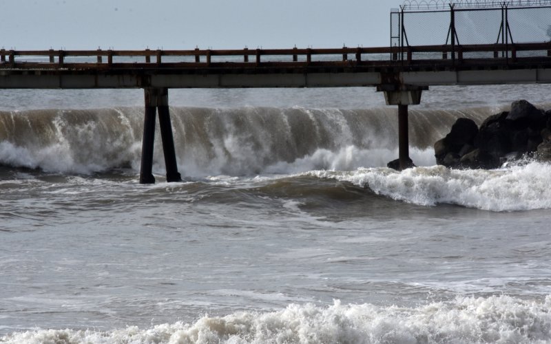
These storm systems, known as “atmospheric rivers,” produce deadly flooding, mudslides, severe thunderstorms and tornadoes, costing an average of $1.1 billion in damage annually on the West Coast of the U.S.
Ryan Torn, chair and professor in the Department of Atmospheric and Environmental Sciences at the College of Arts and Sciences, is an expert on atmospheric predictability and numerical weather prediction models. He’s leading research in collaboration with the Center for Western Weather and Water Extremes that seeks to improve our ability to predict atmospheric rivers along the U.S. West Coast, including where to take additional observations to reduce forecast uncertainty.
Torn was interviewed by Fox Weather last month about the latest series of atmospheric rivers to hit California this month, which he said were “likely to be most high-impact system of the year” for the region.
We caught up with him to learn more about atmospheric rivers and how they can be better forecasted in the future.
What are atmospheric rivers and why are they such a problem on the West Coast during the winter season?
Atmospheric rivers are narrow regions of very high water vapor. As long as that water is moving at the same speed everywhere on the river, you will not get a lot of precipitation associated with them. On the West Coast, atmospheric rivers are problematic because once they run into the north-south oriented mountains, including the Cascades and Sierra, the air is forced to slow down and rise over the mountains, so all that water gets squeezed out of the river either over the mountains or just before. This leads to heavy precipitation, including snowfall. Over 95% of the weather-related damage on the West Coast is associated with atmospheric rivers.
California has been slammed by atmospheric rivers over the past few months. Why?

Pacific storms and atmospheric rivers are what we consider extreme weather events, which are not frequent, so it is difficult to establish trends related to climate change. However, as the Earth warms, you would expect the atmosphere to hold more water vapor, which leads to more precipitation for a given event. Climate change can also alter the frequency of the atmospheric patterns that give rise to these storms, so atmospheric rivers could be less frequent, but more intense.
It is worth noting that tree ring records indicate that California has had many periods of extreme wetness and drought over the past 1,000 years. In the 1860s the Sacramento River, the major river that runs through the northern Central Valley, had periods when it was 30 feet above what we would now consider flood stage.
What is your research like with the Center for Western Weather and Water Extremes?
I am part of a team of researchers that participates in Atmospheric River Reconnaissance (AR Recon). This program is a joint partnership between the Center for Western Weather and Water Extremes and NOAA, meant to improve precipitation forecasts along the West Coast by filling in the observation gaps over the Pacific Ocean. To accomplish this, we are making additional atmospheric observations in the form of buoys, weather balloon launches, and research aircraft that are flown into atmospheric river events.
I have developed methods of identifying locations where to fly our research aircraft that will yield significant progress in reducing uncertainty for precipitation forecasts, known as sensitivity analysis. We run this analysis for every atmospheric river that makes landfall during the winter. We’ve noticed that precipitation forecasts are most sensitive to atmospheric rivers over the Pacific Ocean, and to upper-level low-pressure centers to their north, which can influence the storm's motion.
I got involved with this initiative after I was approached by the co-leads of AR Recon, Marty Ralph, director of the Center for Western Weather and Water Extremes, and Vijay Tallapragada NOAA Senior Scientist. Both are familiar with my sensitivity work with the National Hurricane Center and wanted to extend that work to the West Coast. I’ve had a keen interest in West Coast weather since I was in graduate school in Seattle, so this was a natural fit for me.
How can the West Coast better prepare for these types of storms?
One of the ways that we can better prepare for these storms is to improve our forecasts by making them more precise and long-range, which is the goal of AR Recon. This will increase situational awareness, so the public can prepare sooner and help avoid an unnecessary crisis when floodwaters rise. In addition, these better forecasts will allow water authorities to manage the reservoirs better, letting water out ahead of storms or keeping water in reserve if a dry period is anticipated. One of the major focuses of the Center for Weather and Water Extremes is to develop ways for reservoir operators to better manage these resources, which is critical for those living in the West.