


New Yorkers Turn to UAlbany Research, Expertise for Insight on Dangerous Air Quality
By Mike Nolan
ALBANY, N.Y. (June 13, 2023) – Last week, the eastern United States experienced historically bad air pollution, with transported Canadian wildfire smoke leaving many areas engulfed in an orange-colored hazardous haze for several days.
New York City recorded its worst-ever air quality on Wednesday. At its peak, the Air Quality Index (AQI) for the city reached 405 out of 500 — the highest since records began.
When New Yorkers needed answers, leaders around the state, and the country, turned to the University at Albany’s research and expertise.
Governor at ETEC
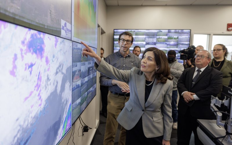
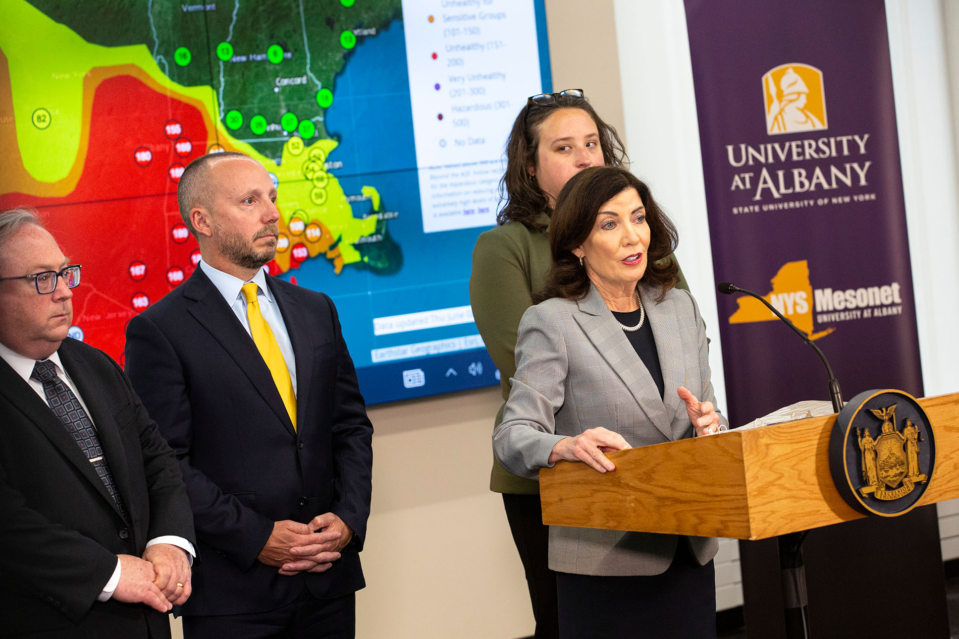
Governor Kathy Hochul visited UAlbany’s ETEC research and development complex twice last week, Wednesday and Thursday, to hold live press briefings with updates on New York's dangerous air quality levels.
Following Thursday’s briefing at the College of Emergency Preparedness, Homeland Security and Cybersecurity's Ops Command Center, Gov. Hochul toured UAlbany’s New York State Mesonet, the nation's most advanced and largest early warning weather detection network. The Mesonet is composed of 126 standard weather stations that are located across the state. The sites collect numerous environment variables in real-time, feeding weather prediction models and decision-support tools for users across New York.
“I want to thank Havidán Rodríguez, president at UAlbany, for hosting us here today at this incredible building, ETEC, which is home to many important assets for the state of New York,” Gov. Hochul said, during Thursday’s briefing. “We have our Mesonet here, which is able to monitor in real-time what is happening with the weather.”
Mesonet Air Quality Monitoring
Along with tracking environmental conditions, the NYS Mesonet provides camera images from each of its standard sites. On Thursday, its Manhattan site captured a timelapse of thick wildfire smoke from Canada moving into New York that went viral.
The Mesonet additionally has a specialized network of 17 profiler sites, each equipped with a Doppler LiDAR and a microwave radiometer that scan the atmosphere and report back in real-time. This data is used to better understand the atmospheric boundary layer, the lowest part of the troposphere that is directly influenced by Earth's surface.
Jim Schwab, senior research faculty emeritus at the Atmospheric Sciences Research Center, explained in a live interview with Fox Weather, how the Mesonet’s profiler instrumentation helps track the impact of wildfire smoke on New York’s air quality.
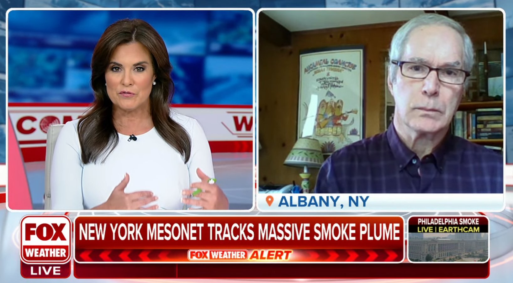
“The LiDARs will tell us whether the smoke is aloft or closer to the ground,” Schwab said. “Sometimes western wildfires, when they bring smoke to us, the smoke is aloft. That will block out the sun and bring these orange sunsets that we were getting a few weeks ago. But the smoke does not come down to the ground and make the horrible air pollution problem that we’re seeing the last few days.”
“Being able to look at whether the plume is impacting the ground or staying aloft is a great quality of these LiDARs.”
ASRC Expertise
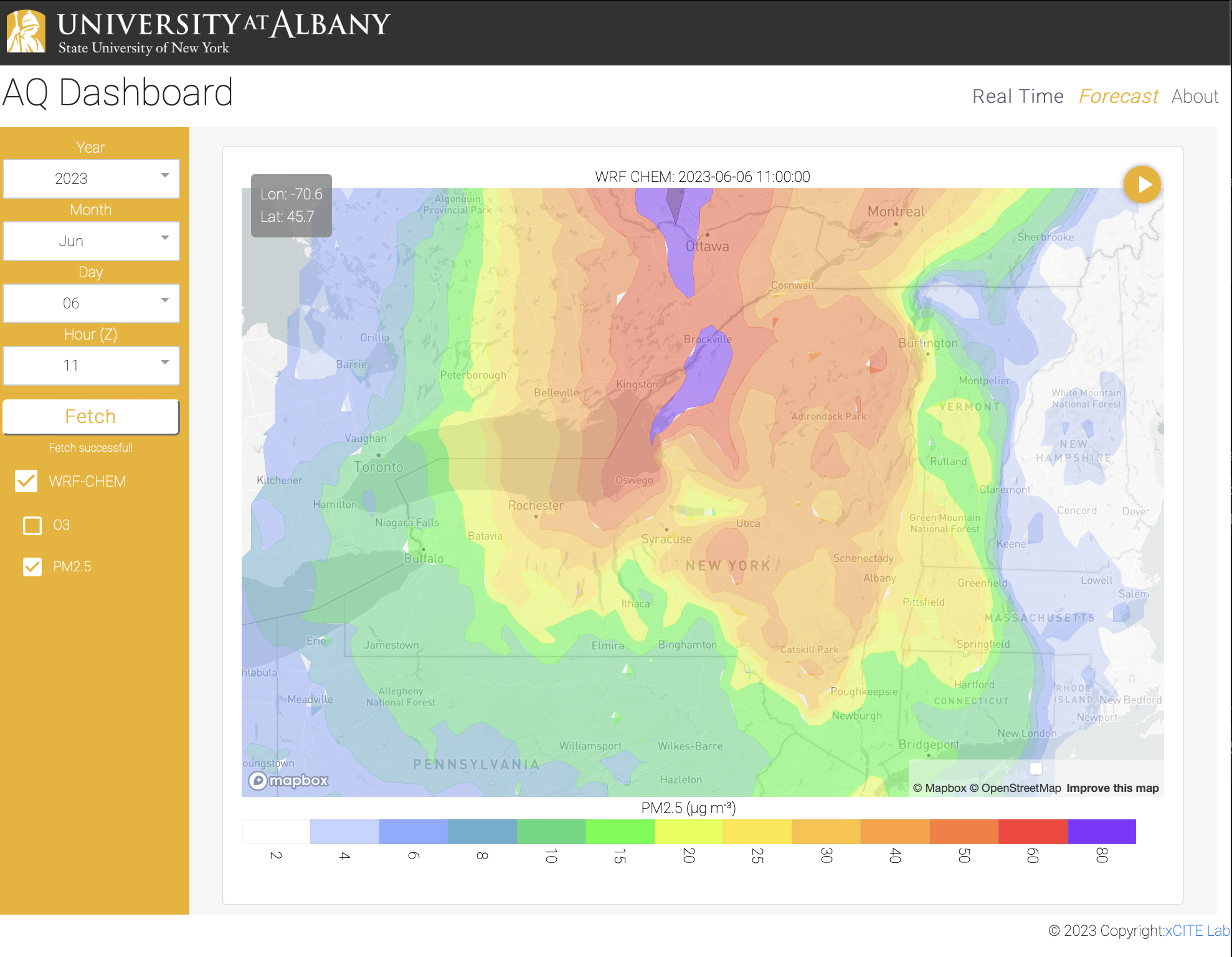
Elsewhere at ETEC, faculty at UAlbany’s Atmospheric Sciences Research Center (ASRC) were closely following air quality conditions in Albany and across New York. This included researchers at UAlbany’s xCITE lab, who built a customized dashboard to monitor and forecast air quality statewide. UAlbany’s Center of Excellence in Weather and Climate Analytics was also closely following New York’s air quality and sharing updates with the state Division of Homeland Security and Emergency Services and Department of Environmental Conservation.
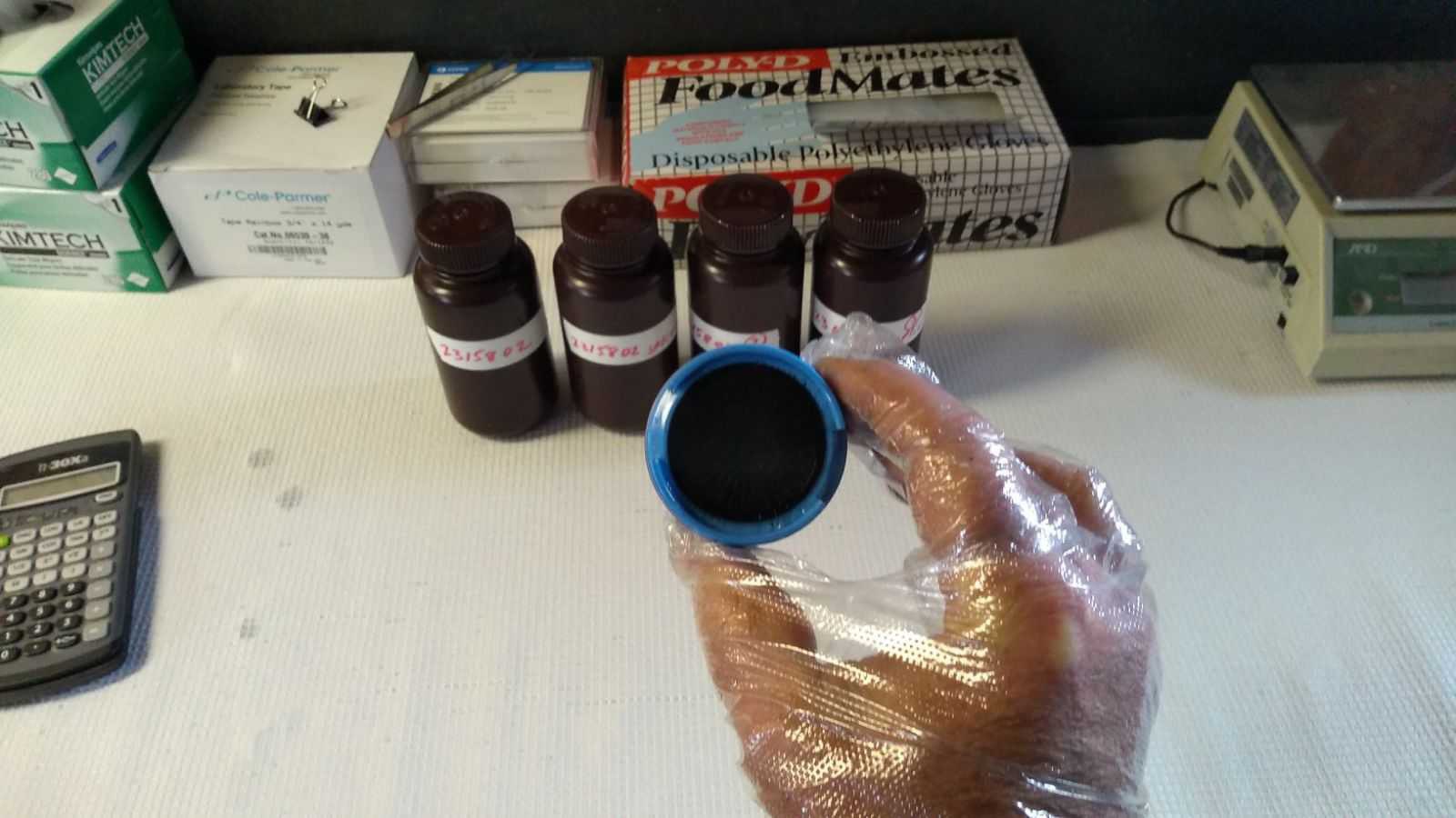
More air quality monitoring was happening up in the Adirondacks at ASRC’s Whiteface Mountain Field Station. At about 5,000 above sea level, the field station has been collecting cloud water samples for chemical monitoring for more than five decades.
On Wednesday, the cloud water samples collected overnight yielded a substantial amount of black carbon, a sooty black material emitted from gas and diesel engines, coal-fired power plants and other sources that burn fossil fuel. The black carbon was attributed to the transported wildfire smoke, with real-time measurements in the air at 10 times normal concentrations.
Scott McKim, an ASRC research support specialist who works at the Whiteface Mountain Field Station, spoke with National Public Radio about the unprecedented wildfire smoke detected at UAlbany’s remote Adirondack research site. The segment was nationally syndicated on more than 100 radio stations across the country.
"This is pretty unprecedented. We haven't seen these spikes in the data in our historical record,” McKim told NPR.
UAlbany air quality expertise and research has been featured in media outlets across the country over the last week. View more coverage.