


Atmospheric Science Faculty, Students Launch Weather Balloons for Capital Region Research Project
By Mike Nolan
ALBANY, N.Y. (Aug. 1, 2023) — When severe weather is looming in the Capital Region, you can find a team of University at Albany atmospheric science faculty and student researchers out in the field, launching weather balloons.
The research team, part of UAlbany’s Department of Atmospheric and Environmental Sciences (DAES) at the College of Arts & Sciences, is leading a summer-long project called ICECREAM (Investigation of Convective Environments in the Capital Region with Expanded Atmospheric Measurements). The project aims to build a vertical profile of the atmosphere around local severe weather events using real-time weather balloon data.
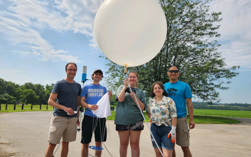
On select severe weather days, the research team, which includes about a dozen undergraduate and graduate student researchers, has been launching balloons from the parking lot of UAlbany’s ETEC research and development complex or other targeted locations in the Capital Region.
“One area that I’ve been interested in since coming to UAlbany is how the complex terrain around the Capital Region impacts severe weather,” said Brian Tang, an associate professor at DAES and ICECREAM co-leader. “We have the Hudson Valley, Mohawk Valley, Catskills to the south and Adirondacks to the north, each playing a role in our weather patterns.
“Our research team is making real-time atmospheric observations in areas that typically do not have data above the surface during severe weather events.”
Tracking Severe Weather
ICECREAM is funded through the UAlbany-NWS Collaborative Science, Technology and Applied Research project, a more than two-decade research partnership between DAES and the National Weather Service that aims to better predict extreme weather events in the Northeast U.S.
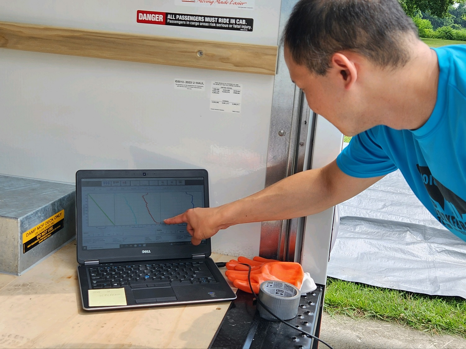
Weather balloons offer a wide range of atmospheric data that can help improve forecast models — such as pressure, temperature, relative humidity and wind speed and direction.
During flights, data is collected and transmitted to a ground computer through a small, expendable instrument package, called a radiosonde, that is attached to the balloon. Each flight lasts around two hours, during which the balloon drifts up to 125 miles and can reach an altitude of 100,000 feet.
“This is kind of a multi-faceted project,” said Ross Lazear, an instructor at DAES and ICECREAM co-leader. “By targeting our balloon launches around impactful weather events, we can better understand the atmosphere’s vertical profile, while also quickly getting the data over to the National Weather Service who can use it to diagnose current conditions and for forecast models.”
Mohawk Valley Weather Balloons
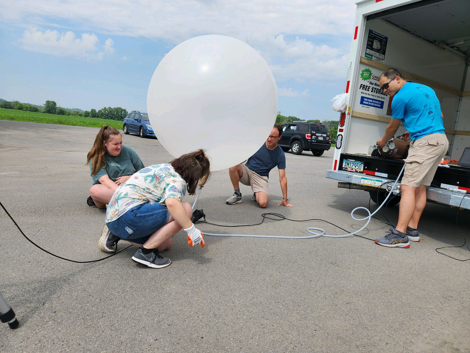
One area of interest for the research team is the eastern Mohawk Valley region, a local hotspot for severe weather. In July, they took a trip to the Schoharie Crossing State Historic Site in Montgomery County, at the intersection of the Mohawk River and Schoharie Creek.
The day included three balloon launches from the site’s Aqueduct Boat Launch, timed around severe thunderstorms, tornado and flood warnings in the area.
Tang and Lazear were joined on the trip by student researchers Rachel Eldridge, Kelly Geiger and recent alumn Erik Creighton, who graduated in May with a bachelor’s degree in atmospheric science.
“I was excited about the trip, as it is connected to my master’s thesis comparing forecast models to observations in the Mohawk Valley region around severe weather events,” said Eldridge, a third-year graduate student at DAES. “By taking vertical measurements, we get a good idea of what’s going on in the atmosphere, which can be used to compare and improve forecast models.”
“This has been a great opportunity to gain hands-on experience outside of the classroom,” added Geiger, a senior at DAES and NWS at Albany intern. “After our launches, I love watching the data come in, knowing that it will be used for research and to support the National Weather Service.”
Lessons from the Sky
The research team will continue to monitor severe weather in the Capital Region and launch balloons through the end of this month.
After the project concludes, its data will be archived for future severe weather research. The data is also being compared to nearby surface observations at the New York State Mesonet, an advanced, statewide weather network operated by UAlbany.
Each of the Mesonet’s 126 standard stations measure temperature, humidity, wind speed and direction, pressure, precipitation, solar radiation, snow depth and soil information. Data is collected in real-time every five minutes, feeding weather prediction models and decision-support tools for users across New York.
Interested in learning more? Follow Brian Tang on Twitter for the latest project updates and weather balloon data.