Albany Rural Cemetery Grave Finder Tutorial
To utilize the Grave Finder tool, Section and Lot numbers, or Section and Tier numbers, must be known!
Welcome to the ARC Grave Finder tutorial. The information is assembled to provide orientation of this location-based application to view data and navigate within the Albany Rural Cemetery. This map tool may be accessed using any Internet connected device including desktop computers, mobile phones or tablets.
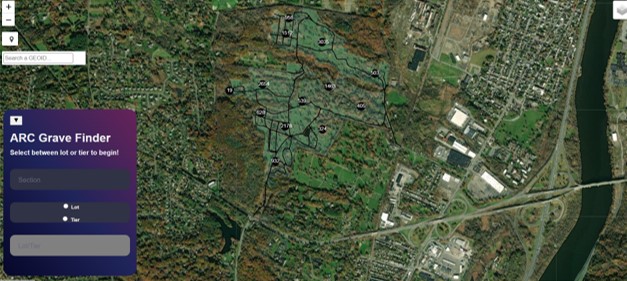
Entering into the application the user is greeted with the full cemetery view using a color satellite image as background.
 The layer list in the maps upper right-hand corner controls the visibility of the cemetery roads and cemetery sections layers on the map. The cemetery sections layer must remain on for the grave finder tool to function.
The full color satellite image background cannot be turned off.
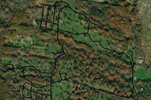
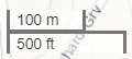
The roads layer (Black lines) distinguishes travel by motor vehicle. In the lower left corner of the map is the scale bar, which changes value as the user zooms in/out. Once a selection is made from the ARC Grave Fider Control Panel zooming in allows the Section boundaries to become visible, further highlighting the road network.
In the upper left corner of the map are a series of control icons. A mouseover of any icon responds with its purpose.

Zoom in/Zoom out. Alternatively, the scroll on the desktops mouse will also perform this function. Dragging with the mouse performs the Pan function.


Where Am I? Using the GPS features of a smartphone or tablet, your current position will be located. GPS position is indicated by a Blue dot. The surrounding lighter blue circle indicaes the accuracy range of your GPS signal.
ARC Grave Finder Control Pannel
This tool allows a search of the cemetery's geographic data to discover a Section & Lot or Section & Tier position. The carrot at the top left will minimize the Control Pannel.
Step 1-Identify the type of search to be performed by selecting either a Lot or a Tier.
Step 2-Enter the number of the Lot or Tier to be located. Once complete, press Enter. You can also use the scroll bar to ascend or descend the numbered list.
Step 3-Enter the number of the Section the Lot or Tier is contained in. Data input will recognize Section 100A as a valid entry.
Usage Notes:
At a map scale of 200 feet or smaller, the selected Section appears on the map as an Orange polygon with a Blue border.Zoming in to a map scale of 100 feet or larger, the section appears as only with a Blue boundary. The satellite image background can assist when navigating within any section.
Activating the Where am I tool will highlight your present position and allow navigatioin to the selected Lot or Tier.
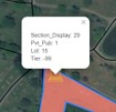 The Yellow headstone image indicates the location of the selected Lot or Tier. For Tiers, the headstone image is positioned at the start of the tier; grave numbers ascending away from the starting location.
Performing a mouse click at the top of the headstone symbol will result in a popup confirming the location.