About us
Applying geographic information science and location-based technoligies to highlight the rich local heritage and the historical treasures of the Albany Rural Cemetery
This project would be impossible without the tremendous efforts made by every member of this collaborative team. A short introduction of each member is below
Contributing Authors
Michael Barrett
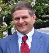
Mark Bodnar

Mark Bodnar has been a Trustee on the Board of the Albany Cemetery Association since January 2018. He is Past President of the Historical Society of the Town of Colonie (2012–2016) and currently serves as an officer on the Historical Society Board. A graduate of Catholic Central High School and Hudson Valley Community College in Troy, Mark is retired from the Watervliet Arsenal. In 2019 he became the Editor of the Friends of Albany Rural Cemetery newsletter.
In the early 1990’s Mark undertook a personal project to document all the Civil War soldiers interred at Albany Rural Cemetery. It became his main hobby. In over 25 years of researching Civil War soldiers and sailors interred at Albany Rural Cemetery, Mark has uncovered numerous fascinating biographical stories of the men and women of the Civil War era, many of which he has authored as articles for the Cemetery newsletter. In addition, Mark has given presentations to countless historical organizations from Hadley-Luzerne to Gettysburg and has served as Master of Ceremonies for several Civil War gravestone dedication ceremonies.
Mark was the primary researcher for “People of Albany: The Civil War” (Peter J. Hess, 2008), and he was a contributor to the more recent book, “These Exalted Acres: Unlocking the Secrets of Albany Rural Cemetery” (Paul Grondahl, 2013). In 2004 Mark and four friends founded The Civil War Buffs history group, now in their 17th year.
Julie O'Connor
Julie O'Connor received a B.A.(comparative literature), MLIS and MPA (public finance) from the University at Albany. She spent her career in the not-for profit and government sectors designing and testing new health care delivery and financing systems.
Upon her retirement she re-discovered her love of Albany history, and has been researching and writing lesser known Albany stories, focusing on women and persons of color in the 19th century.
Julie is a native of Albany; some of her earliest American ancestors arrived here in the 1650's. She estimates that Albany Rural Cemetery contains the graves of at least 100 of her forebears. One of those, James Eights, is included in the Exploring Eternity Project.
Carla Sofka
Tyler Kattrein
Tyler Kattrein is an Albany Rural Trustee and has been visiting and exploring the grounds for over 60 years. Captain Douglas Lodge (Civil War Tour) is his second great uncle, and the Lodge ancestral line goes all the way back through James Douglas who was the right hand of Robert the Bruce, King of Scotland. When not doing historical research, Tyler can be found throughout the grounds cleaning historic, interesting , and private headstones with any proceeds going to the cemetery.
Paula Lemire
Paula Lemire is a lifelong resident of Albany and an advocate for promoting accessible local history. Her first visit to Albany Rural Cemetery in 1985 led to a lifelong interest and love. She has been the Cemetery historian since 2017. She currently serves as the Cemetery’s Media Communications Coordinator and Director of Historical Development for the Friends of Albany Rural Cemetery. She is also a cofounder of the Friends of Albany History, a social-media based project.
Project Staff
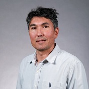
Rui Li
Rui Li joined the Department of Geography and Planning at the State University of New York at Albany in 2014 as an Assistant Professor specialized in topics related to Cartography and Geographic Information Science. His research has a special focus on spatial cognition related to wayfinding and the design of systems that facilitate user’s spatial experiences. Rui grew up in a city in southwestern China called Chongqing and went to Wuhan University along the Yantze River. He then moved to Canada and received his Master degree in Geography at the University of Saskatchewan. He then moved to U.S. and received his Ph.D. degree from the The Pennsylvania State University. Upon graduation, he moved to Germany and worked as a research associate in the Institute for Geoinformatics at the University of Muenster in Germany before he came to the capital region.
Kurt Swartz
Kurt Swartz: AAS in Forestry, BS in Resources Management, MS in Forest Soil Science. He served a career of 34 years with the NYS Department of Environmental Conservation (DEC). IN 1989 he began to practice as a specialist in Geographic Information Systems (GIS), thereafter forming the GIS section of the Division of Lands and Forests, serving as it’s administrator until retirement in 2010. During this period, he directed the transformation of DEC’s forest records from paper maps, desktop databases and hand tally forest inventory practice into a system using geo-spatial data, a centralized Oracle RDBMS and GPS enabled field data recorders. Backed by an ongoing and comprehensive staff training program, forestry staff statewide benefited from advanced technology implementations, speeding work performance, and service ability. During this time, he oversaw the development of statewide recreation data on all DEC lands representing 12% of New York State’s surface area. These data were made available to the recreational public via a WEB based GIS mapping project titled the State Lands Interactive Mapper allowing the public to view, query and print custom recreation maps of all DEC lands. This mapper remains in operation today. As a licensed pilot he further utilized his knowledge in the capture of aerial photography for both natural resources and law enforcement clients. Aside from occupational service, he practiced EMS as a Paramedic, Critical Trauma Care instructor, and EMS lab instructor for HVCC’s Paramedic outreach program. He has been involved with the University at Albany since 2007, providing Undergraduate and Graduate level instruction in Geography and GIS in both introductory and advanced course offerings.
Alexander Buyantuev
Alexander Buyantuev is an Associate Professor in the Department of Geography and Planning, University at Albany. He received his B.S. and M.S. (1988) in Geography from Irkutsk State University in Russia and M.S. (2002) in Natural Resources Management from the University of Arizona. He holds a Ph.D. in Geography (1993) from the Russian Academy of Sciences, and Ph.D. in Plant Biology (2008) from Arizona State University. During his earlier carrier he worked in the Institute of Geography in Irkutsk, Russia, and also taught courses in Cartography and GIS in Irkutsk State University. He is most interested in the interactions between spatial patterns and ecological processes on multiple spatial scales from the experimental plot to the regional landscape. Spatial patterns include fine- to broad-scale variations in climatic, soil, and other biophysical conditions as well as land use and land cover pattern in a geographic area. Specific ecological processes he has been studying include vegetation phenology and primary productivity. His research on urban ecosystem dynamics is directed towards understanding trajectories of land use and land cover in growing urban areas and the role of vegetation on urban microclimates and ecosystem services production. Dr. Buyantuev teaches introductory and advanced courses in physical geography, remote sensing, and landscape ecology. In his remote sensing lab, he currently uses unmanned aircrafts outfitted with a variety of advanced sensors to map spatial patterns of land cover in his field sites of interest.
James Billings
James Billings holds an Associate in Science degree from SUNY Adirondack and a BS degree in Environmental Science (ecosystems concentration) with a minor in GIS from the University at Albany 2020. James joined the project due to experience with programming languages including Java, C# and Python, and knowledge from GIS related courses. His focus was on the development and implementation of the Leaflet web-based user interface for the redesigned Albany Rural Cemetery Explorer. James in depth experience allowed rapid understanding Leaflet library tools, and responses to implementation related challenges.
Aaron Enfield
Aaron Enfield is a graduate student at University at Albany, Department of Geography and Planning. Last summer he worked as a Hazard Mitigation Planner on the 2019 New York State Hazard Mitigation Plan through University at Albany Visualization And Informatics Lab (AVAIL). His prior career path had been primarily in the nonprofit arts and design world, where he has a BA in Theatre, also from the University at Albany. He has worked for organizations such as Proctors Theatre, Hamptons Film Festival, Nantucket Film Festival, Tribeca Film Festival, Washington National Opera, Creative Capital, and FringeNYC. He got into this project having done ancestry work on his own family who have origins in the greater Capital Region and recently discovered that his great aunt is buried in the Albany Medical Center lot at Albany Rural Cemetery.
Ray Bromley
Ray Bromley, AICP, is a Professor at the University at Albany, State University of New York, specializing in Urban, Regional and Rural Planning, and in International Development Studies. He is best known for his work on street vending, urban informality and micro-enterprises, and for his studies of the history of ideas in planning and development. Most of his work has centered on Latin America and the United States, but since 2007 he has also focused on India. Ray was born and educated in Britain and got his BA, MA and Ph.D. degrees in Geography at Cambridge University. He began his career as a Lecturer in Development Studies at the University College of Swansea, now “Swansea University,” and he undertook long and short-term consulting assignments as a regional planning specialist with the United Nations, USAID, and several consulting groups working for the UN, USAID and the World Bank. He moved to the U.S. in 1985 and became a U.S. citizen in 1994. He is the author or co-author of three books, and the editor or co-editor of four books, a nine book series, and four theme issues of academic journals. He has published over 75 articles in academic journals and edited books.
John Pipkin
John Pipkin is Distinguished Service Professor Emeritus of Geography and Planning, University at Albany. He grew up near a Roman road in a small town in England, which had received its modern name, and some of its layout, by the sixth century. Then he went to graduate school in suburban Illinois, where the most of the built environment was a few decades old. Coming to Albany he was relieved to find historical depth again. He became an enthusiastic student of the rich urban fabric of the Capital District. His interests are in urban design, urban planning, architectural symbolism, social geography, landscape history, and public space, working in two distinct traditions: cultural geography, and planning history. He is a member of Washington Park Conservancy and is on the Board of Albany Rural Cemetery.
Jackson LaSarso
Jackson LaSarso is a graduating senior in the Urban Studies and Planning program at the University at Albany. He joined the project from Dr. Li's GIS course, and developed the Grave Finder and Burial Locator tools during his time. Jackson is a member of the Town of Queensbury's Planning Board. He is attending the University of Pennsylvania in Fall 2022 as a graduate student in City and Regional Planning.
Class of GIS Project Development
Special thanks to the class of GIS Project Deveopment which provided user-oriented conceptualization and design of this project's prototype