


Master of Science in Geographic Information Science: Q&A with Dr. Rui Li
Tell us a little about yourself and your role at UAlbany.
My name is Rui Li, Associate Professor in the Department of Geography and Planning. I have been the director of the Master of Science in Geographic Information Science (MSGIS) program since 2020 and am currently serving as the interim department chair.
I entered this field mostly due to my keen interest in maps since I was a child. I love traveling and collecting maps, some of which are now in my office. This led me to study the subjects of cartography and geography when I began my higher education. With the adaption to cutting-edge technology, this field is being further enhanced to support decision-making in many aspects such as business, planning, emergency management, environmental conservation, and health, just to name a few.
What are some of your or the department’s recent research projects?
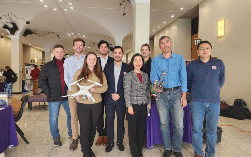
As a department housing both geography and planning fields, projects in my department are very community-oriented and engage both local and global perspectives. Some professors in our department just received large grants to support their research endeavors. We have professors who received a $4 million grant from the Division of Homeland Security and Emergency Services to address hazard mitigation plans for counties within New York. Recently we also had a group of faculty members who received a $5 million grant from the United States Department of Agriculture (USDA) to establish the Institute for Transformational and Ecosystem-based Climate Adaptation (ITECA), which empowers the Albany community with the knowledge necessary to address excessive heat in urban areas. One of my recent projects is of course related to maps. I collaborated with Sociologist and Professor, Samantha Friedman, extracting the redlining score from 1940 historical maps and associating the score with longitudinal health data, one of the very few studies directly addressing the systematic discrimination of redlining.
In addition, our department was also behind the Capital District Vaccine Network during the pandemic. We provided weekly updates on the vaccination progress through our designed interactive map interfaces. We also developed an App for the Albany Rural Cemetery.

What are some career options for students who graduate with an MS in Geographic Information Science (MSGIS)?
Students who graduate from the MSGIS program can choose from a range of careers across various sectors, such as market analysis, transportation planning, natural resource management, environmental conservation, climate adaptation, data science, or emergency management. Some of the most commonly chosen careers include GIS Analyst/Technician, Cartographer, GIS Specialist, Urban Planner, Geospatial Data Scientist, Consultant, Remote Sensing and Imagery Analyst, and GIS Educator/Trainer. With the emerging technology of artificial intelligence (AI), which is closely related to GIS, we have seen students working as Geospatial Artificial Intelligence (GeoAI) Analysts. Our program is in the process of creating a GeoAI initiative to provide degree and certificate training specific to this field which is in high demand on the job market.
Why pursue an MS in GIS? What makes this an exciting field?
There are several reasons that make this an exciting field:
- Geography and planning are interdisciplinary fields, and so is GIS. It combines subfields such as geography, information technology, cartography, computer science, and data analysis.
- Students in this program learn diverse skills that help them to adapt to many different or specific demands in their future careers. These skills also help them to address complex real-world problems with creative solutions from a multidisciplinary perspective. These skills provide students with very diverse career opportunities.
- Demand for GIS professionals continues to increase across various industries. According to the Bureau of Labor Statistics, jobs related to Geographic Information Systems and remote sensing are expected to grow 40-60% nationally in the coming decade, faster than the average job growth. Within New York State, according to Lightcast, occupations related to geography are expected to grow 11.2% during 2022-2027, with 203,733 jobs in 2022, much higher than the national average. In particular, cartographers and GIS-related jobs are expected to grow at 14.65% during 2022-2027.
- The field of GIS benefits from technological advancement. As a field driven by advances in cutting-edge technology such as remote sensing, GPS, Light Detection and Radar (LiDAR), drones, and cloud computing. These technologies can easily be applied to address various issues in many different sectors including government, academia, private sector companies, non-profit organizations, and consulting firms.
What makes the program at UAlbany unique?
The combination of location, application, flexibility, diversity, and accessibility makes the MSGIS program at UAlbany unique and well-suited for students seeking to advance their careers in the era of the geospatial revolution.
Location. Located in the capital region of New York State, our program provides students access to a wide range of opportunities for professional development in government agencies, consulting firms, private companies, and non-profit organizations. We have signed multiple Memorandums of Understanding (MOUs) with state agencies such as the Department of Environmental Conservation and the Department of Health to provide our students with paid internship opportunities where they not only receive financial support but also professional development through solving real-world problems.
Application. Built on the theoretical foundations of geographic information science with an emphasis on practical applications of geospatial technologies, students in our program gain a deep understanding and hands-on experience working with spatial analysis, geospatial statistics, cartography, remote sensing, and artificial intelligence.
Flexibility and Accessibility. The curriculum for MSGIS is flexible, allowing students to tailor their coursework to their interests and career goals. Our elective courses as well as many courses offered at different departments provide students cover a wide range of topics for students to choose from. Our MSGIS program offers both in-person and online options for students who may be working professionals or living abroad. The online version of this program allows students to access the same quality instructions and materials as on-campus students while having other commitments.
Diversity. Faculty members in this program bring their diverse expertise from their specific fields of teaching and research. Students can work alongside faculty members on projects and gain hands-on experiences with cutting-edge geospatial technologies. Our GIS student body is a very diverse group consisting of many women and minority students. Providing STEM education to underrepresented groups is a consistent pursuit of our program.