Working with the GeoTools
Library in Java
GeoTools is part
of the OSGeo
project
OSGeo is the parent project for GDAL,
QGIS, GRASS GIS, OpenLayers, and other projects
The GeoTools library is
�an open
source (LGPL) Java code library which provides standards compliant methods for
the manipulation of geospatial data, for example to implement Geographic
Information Systems (GIS). The GeoTools library
implements Open Geospatial Consortium (OGC) specifications as they are
developed. � (from http://www.GeoTools.org/about.html)
In other words, you can create a whole GIS from these tools�impressive!
You
can learn how to use GeoTools in a Java program here
Take it slowly�these are advanced installation instructions
GeoTools projects are built with Maven, a
build tool that ships with Eclipse
Maven organizes your project so that you only need to
download a small part of the GeoTools library for any
given project
Although you could do this manually, it�s actually easier to
just follow the instructions in the Eclipse Quickstart
guide and figure out how to use Maven
You probably already have the Java JDK and at least the Neon
version of Eclipse
At the time of this writing, having installed the same
materials as you, I was able to begin the Quickstart
instructions at Creating a Simple Maven project
You should do the same, and continue through the tutorial
until you reach the Alternatives to
M2Eclipse section (you don�t need to go further)
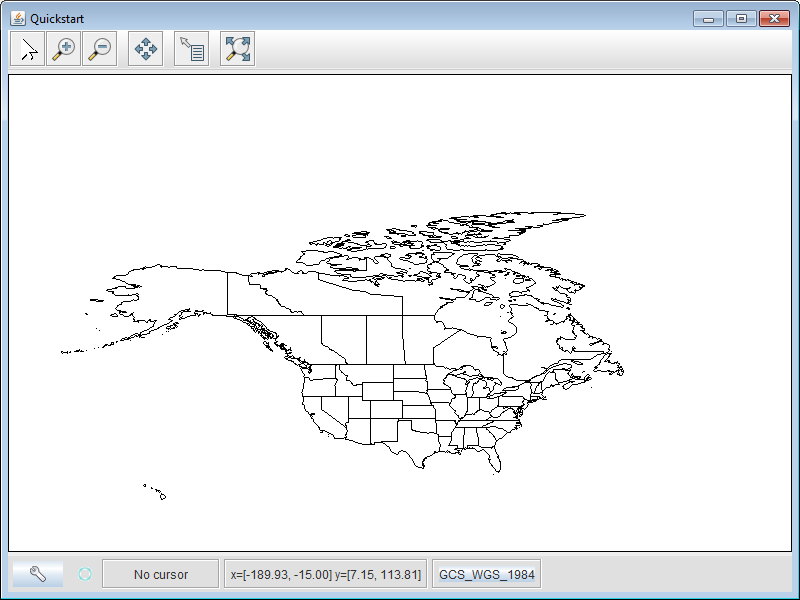
At the end of the tutorial, I was able to get the Quickstart project to create the following graphic:
How is GeoTools
organized?
This page
provides an overview of the GeoTools library
The
User Guide provides tutorials as well as information on specific library
commands