Spatial Analysis Laboratory

Jiang Group

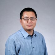
Principal Investigator: Shiguo Jiang

About

Dr. Shiguo Jiang's research focuses on understanding land use/land cover change, forest/agriculture ecosystem dynamics, and human-environment systems through the integrated use of geospatial information technologies (GIS, remote sensing, GPS) and spatial statistical methods.

His group's major research interests include:

  • Remote Sensing, GIS and Spatial Statistics

  • Land Use Land Cover Change

  • Climate Change and Environmental Modeling

  • Vegetation Ecology

  • Terrestrial Carbon Cycle


Join the Jiang Group

New members must complete a two-hour training, which can be arranged in either a 2-hour session or two 1-hour sessions. Please read the training materials and schedule training with me.
 

Graduate Students

Current Graduate Students

If you have already been admitted to a graduate program at UAlbany, then please get in touch ([email protected]).

I am happy to collaborate/serve as advisor/committee member for students from Department of Geography and Planning, Department of Sociology, Department of Information Science, School of Criminal Justice, School of Public Health, or any other departments and institutions.

Currently, we have no fund for Graduate Research Assistants (GRA). However, I will be happy to work with you if you can identify other funding resources. Please feel free to contact me if you are interested in my lab.

Prospective Graduate Students

Unfortunately, I am unable to respond to most queries from prospective students who have not yet been admitted to a graduate program at UAlbany. Apply to the Graduate School.

I am affiliated with the PhD Program in Department of Information Science, College of Emergency Preparedness, Homeland Security and Cybersecurity, UAlbany, where I recruit PhD students. For those who want to work with me as PhD students, please apply to the Information Science PhD program.

Undergraduate Students

Undergraduate students interested in research are encouraged to contact me ([email protected]) for possible research projects.

Students should be familiar with one programming language (such as C++, Java, Python, R, IDL or Matlab). Experiences with one geospatial software (ENVI, Erdas, ArcGIS, QGIS, etc.) is also required.

Students from any major are welcome to contact me for possible collaboration and research opportunities.

Postdoctoral Researchers

Currently, we have no positions for postdoctoral researchers. New openings will be announced once they are available.

Visiting Scholars

Visiting scholars with research interests related to our lab are strongly encouraged to contact me ([email protected]).

Research

Land use/land cover change, climate change, and policy

An early paper (Jiang and Zhou 2006), funded by the National Natural Science Foundation of China, examined urban sprawl of Beijing using remote sensing, GIS, and fractal theory. This study finds that Beijing has experienced continuing decentralization, leapfrog development, and segregation of land use.

Later, Jiang received a research grant from Office of International Affairs, Ohio State University, to revisit this question by employing a new method to estimate a compactness index of urban form. The study, reported in Jiang and Liu (2012), shows that the central city of Beijing is highly compact, confirming several findings by others, but also shows that the extent and magnitude of urban sprawl and compactness have significant impact on urban environment including especially urban heat island and local meteorology.

Both studies relate to policy decisions for urban planning and land management.

In joint work with Wainwright, Liu, and Mercer, we conduct a thorough analysis of forest/agriculture use by Mayans in Southern Belize (Wainwright, Jiang and Liu 2013; Wainwright, Jiang, Mercer and Liu 2015; Jiang, Liu, Wainwright, and Mercer, in preparation). This pertains to the long dispute between Maya communities and the Government of Belize as to Maya's indigenous title to forest lands from which they produce a livelihood. A central element in this contention is that Maya communities destroy the forest through "slash and burn" farming.

Encouraged by the Maya Leaders Alliance, we analyze forest change in Southern Belize using remote sensing and GIS. Our work reveals contrasting results:

  1. For areas where customary Maya land use and tenure have been consistently practiced since the colonial era, forests are relatively stable.

  2. For areas where customary Maya land use practices are no longer the norm, significant deforestation is observed. This work suggests that the popular association of "slash and burn farming" with "deforestation", or the so-called "Maya deforestation", may not be true. A broader implication is that integration of political ecology (PE) and land change science (LCS) can lead to "policy adoptable" results.

Spatial data quality

An important technical issue in land use/land cover change research is spatial data quality. As land use maps are usually derived from remote sensing image classification, the question turns to the spatial quality of image classification. We develop methods for solving this problem, showing that class membership probabilities can be used to represent spatial data quality.

Methods on spatial classification quality can be grouped into into three types: regression-based, interpolation-based and score-based. Among these, the score-based method is more often used because it has fewer limitations than the others. Under this approach, class membership probabilities (i.e., scores) output from a classification method are used to represent spatial data quality at the pixel level.

Urban studies: multiple angles

Currently, we are working on three projects related to cities and urbanization (stay tuned for detailed results):

  • Urban crime

  • Housing abandonment

  • Urban climate

Penology: Global warming on forest change

This is a new project in collaboration with the labs of Drs Lapenas and Buyantuev.

This project is partially funded by U.S. National Science Foundation (NSF) Major Research Instrument (MRI) grant. We obtained an Unmanned Aerial System (UAS) through this grant.

Also check out our Phonocam installed at the Huyck Preserve and Biological Research Station.

Publications

Members


Principal Investigator

Shiguo Jiang
Associate Professor and Program Director - Geography BA
Arts & Sciences 227


Current Students


Agostinho Rodrigues

Masters student

Research interests: Land use/land cover change, environment risk


Yichao Gao

PhD student

Research interests: Spatial analysis of crime (co-advised with Dr. Matt Vogel)


Former Members

Undergraduate Students

Alyssa Kamara
Research interests: Maya forest

Jonathan Hehir
Major: Mathematics
Minor: Geography
Research interests: Urbanization

Kevin Sheehan
Major: Mathematics
Research interests: Geometric process/positioning of remote sensing images.

Graduate Students

Yutian Feng
PhD student
Research interests: Spatial data analysis

Haemi Won
PhD student (co-advised with Dr. Worden)
Research interests: Spatial analysis of crime

Mohammed Alazawi
PhD student
Research interests: Spatial analysis of crime

Yutian Feng
Masters student
Research interests: Housing abandonment

Nafin Harun
Masters student
Research interests: Public health - early intervention

Postdoctoral Researchers & Visiting Scholars

Samanpreet Kaur Baweja
Visiting Scholar (co-advised with Dr. Lal at The Ohio State University)
Research interests: Geoinformatics for natural resource management

John B. Davis
Visiting Research Scientist
Research interests: Environment Conservation/Ecological Modeling

Asma Hassana
Visiting Scholar (co-advised with Dr. Lal at The Ohio State University)
Research interests: Soil carbon dynamics

Toru Nakajima
Postdoc (co-advised with Dr. Lal at The Ohio State University)
Research interests: Soil quality